
Tracing a Radnor Township Street
A Radnor Township street directory search begins with one known address, not a sweep of names. Delaware County’s public property route is built around address, Parcel ID, and map access because public name searching was removed. That first result gives a parcel key and exact street form. The key can then connect to recorded documents, map context, older community labels, and a focused Township request when a permit or inspection record is needed.
Recorded parties, property owners, and occupants are not interchangeable. A deed names parties to a land transaction. A tax-bill mailing address, if shown on a live record, is for correspondence and may differ from the physical situs. A street directory is most dependable when it reports what a dated source actually establishes and leaves unconfirmed household details with the custodian.
- Enter a specific Radnor Township address in the Real Estate/Tax System and save the exact address and Parcel ID.
- Use the county map route to examine parcel context, then treat each nearby parcel as its own record task.
- Search the Parcel ID in Recorder Cloud Search and compare the legal description, party roles, and recorded date.
- For a historical address, test the older community labels and compare a dated directory or map with the parcel trail.
- Ask the proper county or Township office for a focused, nonexempt record when an online route ends.
Radnor Address-First Parcel Search
The Delaware County Real Estate/Tax System is the useful front door for a Radnor Township street directory. The public navigation confirms four routes: Search by Address, Search by Parcel, Advanced Search, and Map Search. It also requires agreement to a privacy notice before direct search pages. The county has explicitly removed name searching and property photographs, so an address-first workflow is a deliberate privacy boundary rather than a missing feature.
Start with the number and street spelling already in hand. If the returned record lawfully displays a Parcel ID, carry that value to the Recorder and retain it with the address. The source review did not open a live parcel card, so current displayed fields such as a mailing address must be confirmed on the actual record instead of assumed.
| County route | Input verified by the source | Street-directory use |
|---|---|---|
| Search by Address | Street address | Find the county parcel record and its exact address form. |
| Search by Parcel | Parcel ID | Return to a known county land object. |
| Advanced Search | Route visible, fields not captured | Use the live screen without assuming unobserved fields. |
| Map Search | Map or area selection | Understand parcel context before checking documents. |
The Delco Real Estate/Tax System is the county’s verified address and parcel entry point.
Radnor Parcel IDs in Cloud Search
The Recorder’s Cloud Search is the recorded-document layer of a Radnor Township street directory. Its quick screen accepts a Parcel ID in the format xx-xx-xxxxx-xx, plus a search term, date controls, and Index Only or Index & Full Text OCR scope. The advanced screen adds party, grantor, grantee, recorded-date, instrument-date, document-number, document-type, volume, book, page, OCR-text, and municipality controls.
A Parcel ID is a strong bridge because it is tied to the county land record. A street-name hit alone is weak: a long road can cross communities, a road may appear only in a mailing address, and OCR can misread older pages. Start broadly, then narrow only after comparing the parcel, document number, land description, and party role.
Recorder Cloud Search quick search shows the public controls and scope choices.
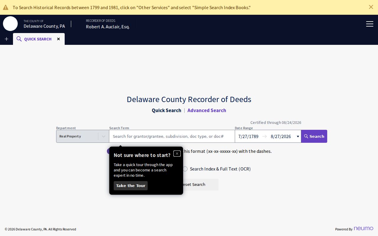
The quick search screen supports an index-led document trail from a parcel or confirmed recorded party.
The advanced Recorder search adds the party and document filters used to refine a dated instrument trail.
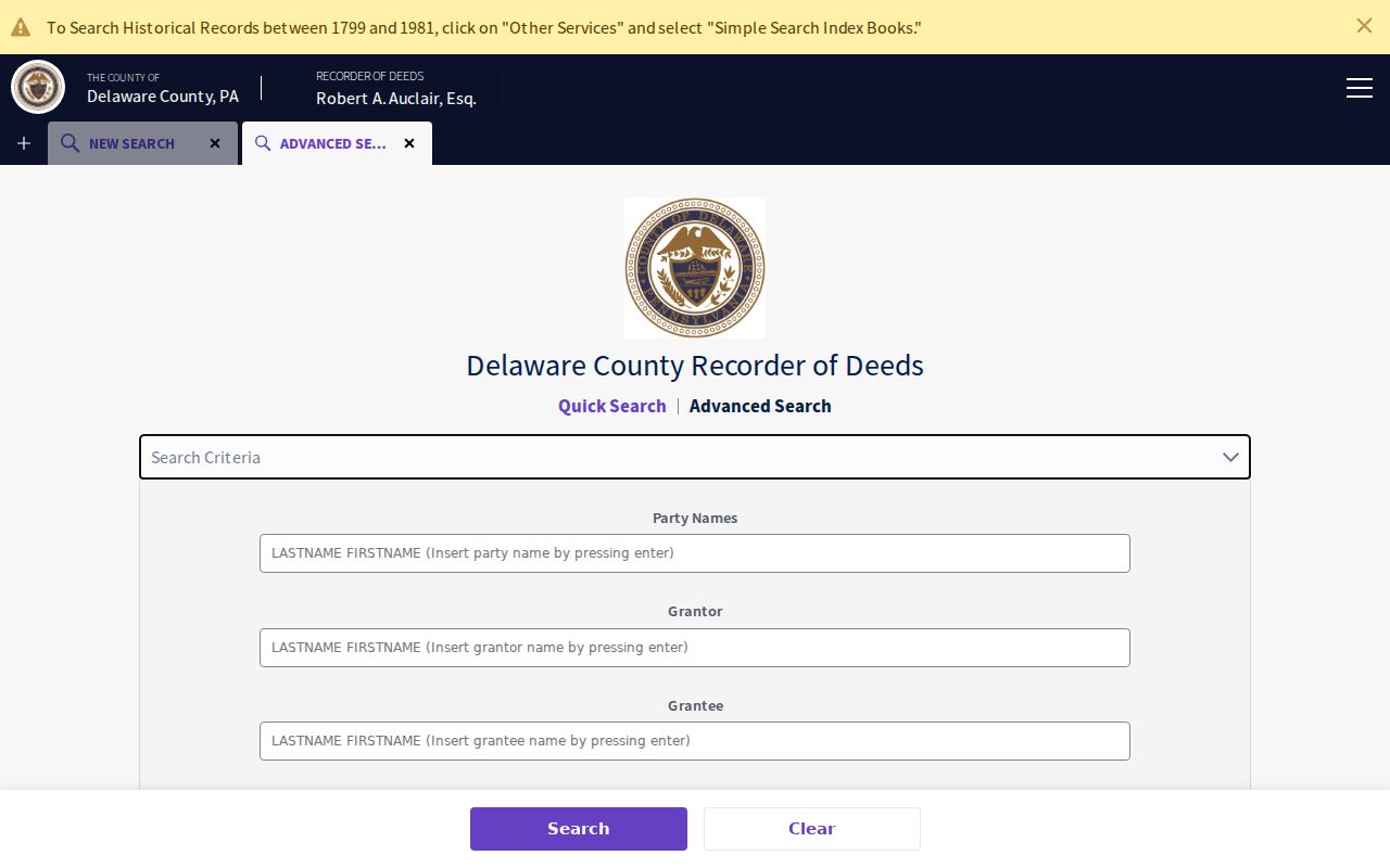
Advanced fields can narrow an actual record search without turning a street into an unverified roster.
Radnor Township Street Record Sources
Address-keyed sources work as a chain, not as a single Radnor Township street directory. The assessment route establishes a parcel-management key. Recorder documents can identify parties and legal-description clues. County map information provides parcel context. Township permitting may document a construction or approval timeline. Election street lists have their own statutory inspection and use limits. Together, these sources help a researcher describe an address trail with the right caution.
| Address record set | Custodian | What it can establish | Access channel |
|---|---|---|---|
| Real Estate/Tax System | Board of Assessments | Address, parcel route, and assessment context | Address, parcel, advanced, or map route |
| Parcel maps/data | Board of Assessments / ODMI | Boundaries and property context | Public route or GIS property-map request |
| Recorded deeds and plans | Recorder of Deeds | Recorded party roles, dates, and legal descriptions | Cloud Search, copies, or office counter |
| Election street list | Delaware County Voter Registration | Registered-elector list under Election Code terms | County-office inspection with safeguards |
| Permit and code material | Radnor Community Development | Construction and approval chronology | Department inquiry or focused RTKL request |
The Parcel ID and legal description make the chain durable when a historic document lacks a modern house number. For a deeper current address route, use the Radnor Township resident lookup only when the question becomes one named person and a dated record.
Radnor Street Names Over Time
Modern street labels do not cover all historical Radnor Township records. Early material can be cataloged as Wayne, St. Davids, Villanova, Ithan or Radnorville, Garrett Hill or Garretville, Rosemont, or a named estate. Township history describes the 1717 trail that became Conestoga Road, the 1832 railroad, and the Louella development that became Anthony Wayne and then Wayne. Those community-name changes are a practical source of false negatives.
No authoritative source confirmed a Township-wide street-renumbering project or year. When an old listing seems to disappear, compare its map intersection, parcel or legal description, lot or subdivision, estate name, and road alignment. The correct local bridge is a historical place name or land description, not an invented replacement number.
- Parcel
- The county’s identifier for a land record, which can carry an address research chain across systems.
- Situs address
- The physical property location as a record displays it, distinct from a mailing address when both appear.
- Plat or plan
- A recorded drawing or plan that can connect lots, a subdivision, and a land description.
- Criss-cross directory
- An address-to-name format; no confirmed Radnor shelf run was located, so ask the library or Historical Society first.
Radnor Permit Records by Address
Radnor Community Development is the local address-chronology source for construction, zoning, certificate-of-occupancy, contractor-license, electrical, and demolition material. The Township says most work needs a construction permit and that contractors must be Township licensed. Its reviewed public resources do not provide a person-searchable permit database. A permit can help date construction, an addition, a demolition, or an inspection event, but it does not prove that every person at an address lived there.
For an offline record, request a defined category for a defined address and period. The Township Open Records Officer accepts portal, email, fax, mail, and in-person submissions. Identify the street, approximate dates, and whether you seek an application, permit number, inspection, certificate, or code file. That makes the request usable under the Pennsylvania Right-to-Know Law’s response framework.
Radnor Election Street List Limits
Pennsylvania Election Code section 1403 calls for a pre-election street list arranged so an elector’s residence location can be identified, and it allows public inspection in the county office under safeguards. Section 1404 public-information lists and section 1207 add identification, attestation, and purpose restrictions. The public online registration form is an individual status channel, not an online Radnor Township street directory.
Delaware County Voter Registration is the proper local contact for an official list or inspection question. The process can establish a limited, lawful election-record connection. It cannot be used to publish a household list, expose a protected address, or infer how someone voted.
Radnor Parcel Map Context
County mapping is useful for seeing the physical relationship between a target parcel and surrounding land. The Office of Data & Mapping Innovation says parcel information is maintained by the Board of Assessments and directs users to the public records route. The review did not establish a specific neighbor, radius, measure, or ownership-pop-up tool. A defensible method is to identify each parcel by address or Parcel ID, inspect its context, and verify that parcel independently.
Delaware County mapping access is the official starting point for that parcel context.
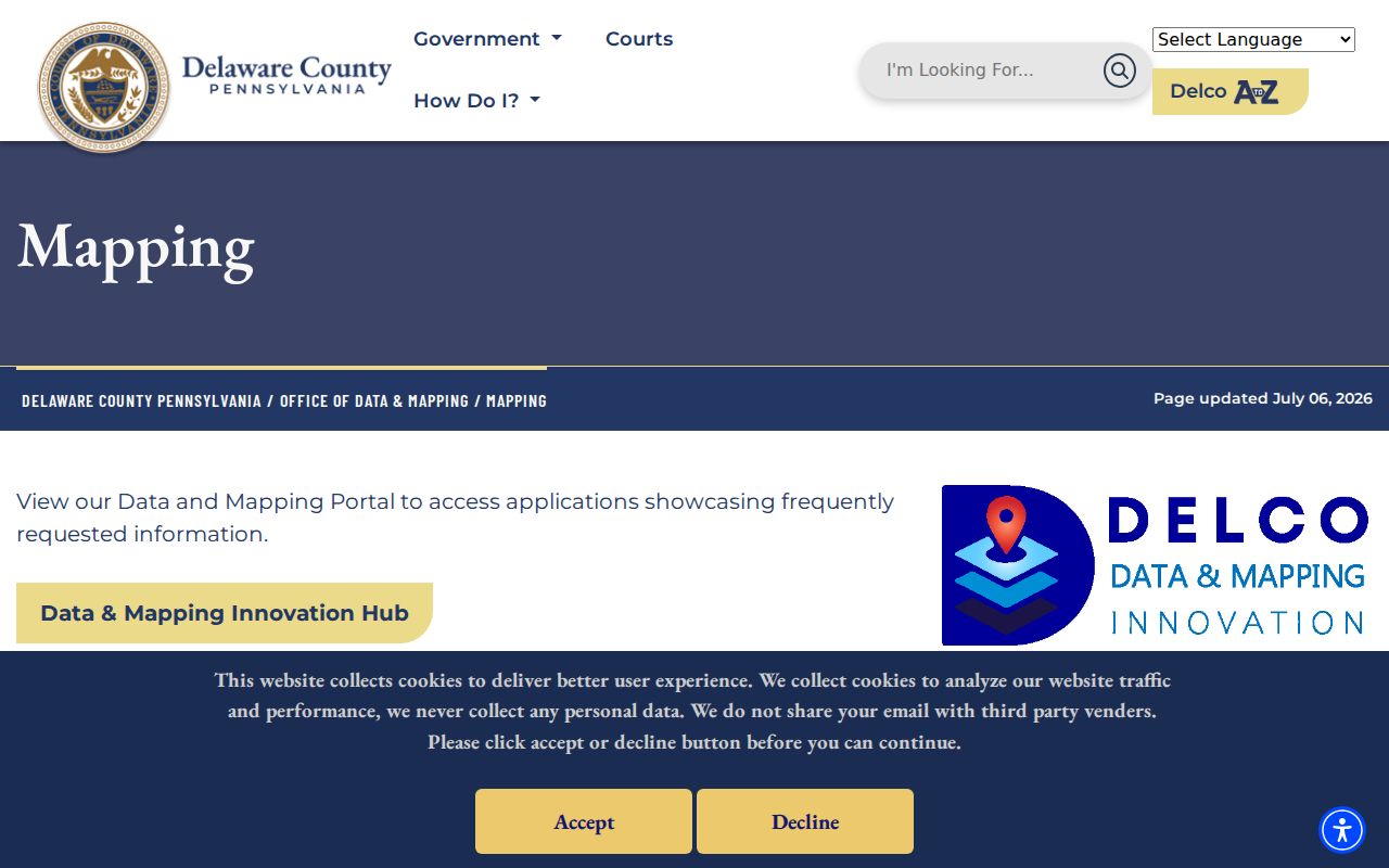
The county mapping page routes a street researcher to parcel and public-access resources without promising unverified map controls.
Radnor Recorded Parties, Not Households
A recorded owner or other document party is not a complete household list. The county’s removed name search, the absence of a public utility-customer index, and limits on motor-vehicle information are real privacy boundaries. A historical directory may identify a subscriber, business, or listed connection rather than every resident. Use source-specific language such as “named in a recorded deed” or “listed in the 1904 directory,” then retain the date.
That restraint also improves a street directory’s accuracy. It keeps a property trail tied to the records that exist and prevents a mailing field, a map boundary, or an old printed entry from becoming an unsupported claim about a person’s current location.
Radnor Street Directory Limits
A Radnor Township street directory cannot show every adult household member, visitor, utility customer, motorist, or person who receives mail at a property. It also cannot bypass an Address Confidentiality Program substitute address, court restriction, vital-record limit, or a custodian’s lawful redaction. A quiet search result is not proof that a person is absent from the community or that no record exists.
Lawful use. Radnor Township address records are for personal, lawful research. Do not use an address, parcel, or record trail to stalk, harass, intimidate, or harm anyone.
Radnor Street Research Fallbacks
When the online trail stops, follow the record’s access channel. The Recorder has office copies and older document assistance; county mapping staff can address property-map and parcel-data questions; Community Development and the Open Records Officer handle a focused Township request; and Radnor Memorial Library and the Historical Society can be asked for exact local directory or telephone-book holdings. Historical materials should be requested under the community name and time period they use.
County Recorder holdings date from 1789, with online copies from 1799 to the present. For older or unclear land material, the counter, physical books or indexes, and archival repositories are the responsible next steps. A gap should stay a gap until a documented record bridges it.
For the oldest Radnor Township street evidence, the historical setting can be as useful as a modern search field. The Society identifies Streets, Estates, and Genealogy files, builder and store daybooks, historic maps, and a resource survey with address and alteration details. These collections can explain a street’s earlier name or development era. They do not replace the Recorder’s land record, but they help frame a precise request and a careful comparison.
Note: A concise request that names an address, date range, and record type is more useful than a request for everything connected to a street.